Before you book a stay in Djerba, a good island map is worth a thousand Google searches. Djerba has three main municipalities, two very different coastlines, around a dozen distinctive villages and roughly twenty beaches — getting the layout right will shape your whole family holiday. This visual guide walks you through the geography of Djerba island so you can choose where to stay, plan your days, and spot at a glance the places worth your time on this Djerba island map.
Djerba island in brief: a singular geography
Djerba is the largest island in North Africa. It sits in south-eastern Tunisia, in the Gulf of Gabès, around 500 kilometres south of Tunis. The island covers roughly 514 km², which puts it in the mid-sized Mediterranean category. It is home to about 160,000 permanent residents, mostly Muslim, with a long-established Jewish community concentrated in Hara Sghira and Hara Kbira.
Its shape resembles a rounded square, roughly 27 km east to west and 28 km north to south. The highest point barely reaches 50 metres: Djerba is flat, which makes cycling accessible at any age and lets children ride safely along the coastal lanes. That flatness also explains the very old patchwork of palm groves, olive groves and menzels — the traditional fortified farmhouses with inner courtyards — that still defines the rural landscape.
The island connects to the mainland in two ways. The first is a restored ancient Roman causeway running from El Kantara towards Zarzis, to the south-east. The second is a regular ferry that crosses between Ajim and Jorf, to the south-west. Most travellers, however, fly in to Djerba-Zarzis International Airport (DJE), located on the western side of the island, just outside Mellita. Direct flights from London, Paris, Brussels, Geneva, Zurich and other European cities serve Djerba seasonally; the journey from London is typically around three hours.
The three main municipalities on the Djerba island map
Djerba is administratively divided into three municipalities, and they shape how you read the map. Understanding this layout makes choosing where to stay much easier — each area has its own pace, its own beaches and its own atmosphere.
Houmt Souk — the historic capital in the north
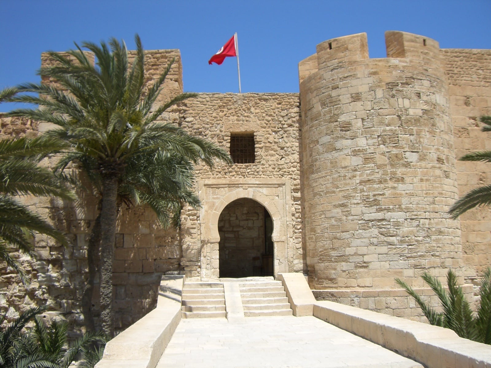
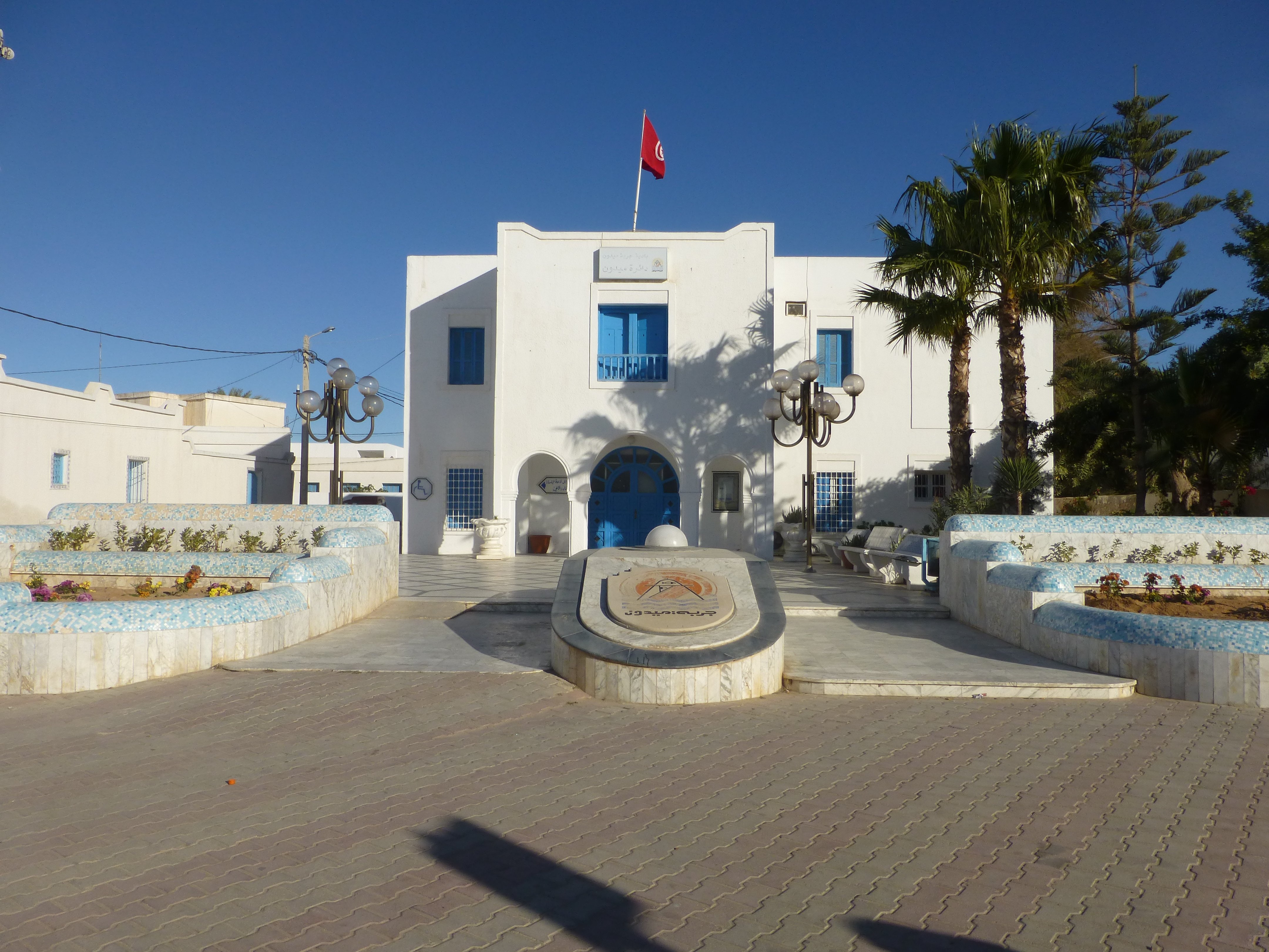
Houmt Souk is the administrative capital of Djerba. On the northern coast, it gathers the markets, the fishing port, the local government and the medina. The town is known for its whitewashed alleys, its old funduqs (caravanserais) now converted into boutique hotels, the daily fish auction at the port (the bidding starts mid-morning) and the Ottoman fort — Borj el-Kebir, also called Borj Ghazi Mustapha — which has guarded the harbour entrance since the 15th century.
This is where you go for fresh fish, a stroll through the medina, woven rugs, Guellala pottery or hand-crafted jewellery. From Tezdaine, Houmt Souk is around 20 minutes by car — perfect for a half-day outing. The mood shifts through the day: bustling at the fish market in the morning, slower and golden by late afternoon when the light catches the white walls.
Midoun — the traditional heart in the east
Midoun, on the east coast, is the second municipality by population. It feels more authentic than the Tourist Zone running along its northern edge, and it is known for its Friday morning market (one of the most colourful in Tunisia), its endless olive groves, its traditional menzels and its scattered villages — Mahboubine, Beni Maaguel, Sedouikech. Midoun is where you’ll find Tezdaine, the area where we have been welcoming travellers for the past five years at Ethic Village Djerba.
Tezdaine — which means “the palm trees” in Berber — is a sought-after corner of Midoun, halfway between the calm of the olive groves and the closeness of the coast. Sidi Yati, the wildest beach on the east coast, is six minutes away by car. The Troujette mosque is three minutes on foot from our villas; the Khalid Ibn Al Walid mosque, five minutes. The bakery, the grocer and the first shops of central Midoun are a short cycle away. That balance — neither in the Tourist Zone nor deep in the countryside — is what defines a stay in Tezdaine.
Ajim — the ferry port in the west
Ajim, the third municipality, sits on the south-western tip of the island. Its port runs the daily ferry to Jorf on the mainland. Ajim is known for its quiet pace, its surviving sponge-fishing heritage, and for having served as a backdrop for several Star Wars scenes shot in the 1970s — fans will recognise Ben Kenobi’s house, just outside the village, now a small pilgrimage site for cinephiles. If you plan a day trip to the mainland (Sahara, Tataouine, Matmata), Ajim shaves around half an hour off the journey compared with the Roman causeway.
Beaches on the map: where to swim, by mood
Djerba alternates two coastal moods: a very open, breezy north-east coast where wild beaches sit alongside the large hotels of the Tourist Zone; and a more sheltered west and south coast, sometimes lagoon-like, sometimes rocky, but always with fine pale sand. Here is how to read the beach map according to what you actually want.
Sidi Mahres — the long Tourist Zone beach
Sidi Mahres stretches along the north-east coast, between Houmt Souk and Midoun. This is the resort beach: several kilometres long, fine sand, shallow water for 50 to 100 metres — perfect for children learning to swim. Busy in summer, it loses most of the crowds in May, June and September. Camel and horse rides along the shore are a long-standing family attraction.
If you stay in the Tourist Zone, you are right on the beach but far from the traditional villages. Stay in Tezdaine, and Sidi Mahres is around 15 minutes by car — close enough for an afternoon, not so close that it becomes your daily backdrop.
Sidi Yati (Yéti 2) — the best-known beach on the east coast
Sidi Yati — also known as Yéti 2 — is the best-known and most tourist-frequented beach on Djerba’s east coast. Six minutes by car from Tezdaine, it has the signature look of the island’s beaches: pale sand, turquoise water, open horizon. A handful of beach shacks and seafront restaurants line the coast — no heavy infrastructure. Insider tip: coming early in the morning is often the best way to swim in peace, before the excursions and families arrive.
Plage de la Seguia — the family choice
Further south on the same coast, Plage de la Seguia is our pick for families with young children: golden sand, shallow water for several metres, little current, easy-going atmosphere. Free parking and a few beach snacks nearby. Ideal for a relaxed half-day without organising a full excursion.
Ras Rmal (Flamingo Island) — the pirate-boat trip
Ras Rmal is the sand spit that becomes an island off the north tip at high tide. It is also the destination of the pirate-boat trip, Djerba’s best-known tourist attraction: departure from Houmt Souk, themed sailing for the kids, a swim stop on this empty sand bar, lunch served on board. In winter and early spring it is one of the best spots to see flamingos in large colonies. Plan a full day for the outing.
Aghir and the south coast — water sports
For organised water sports — kayak, paddleboard, windsurf, swimming lessons — the southern stretch of Aghir is the best address. Beach bases rent equipment by the day and run supervised outings for families with teenagers.
The west coast — Sidi Jmour and traditional fishing
The west coast, less travelled, runs along small fishing harbours and quiet beaches. Sidi Jmour is known for its beachside hammam, its small white seafront mosque and its sunsets over the Bou Grara lagoon. It’s the side of the island most first-time visitors miss, but it rewards anyone who makes the drive.
The villages worth circling on the map
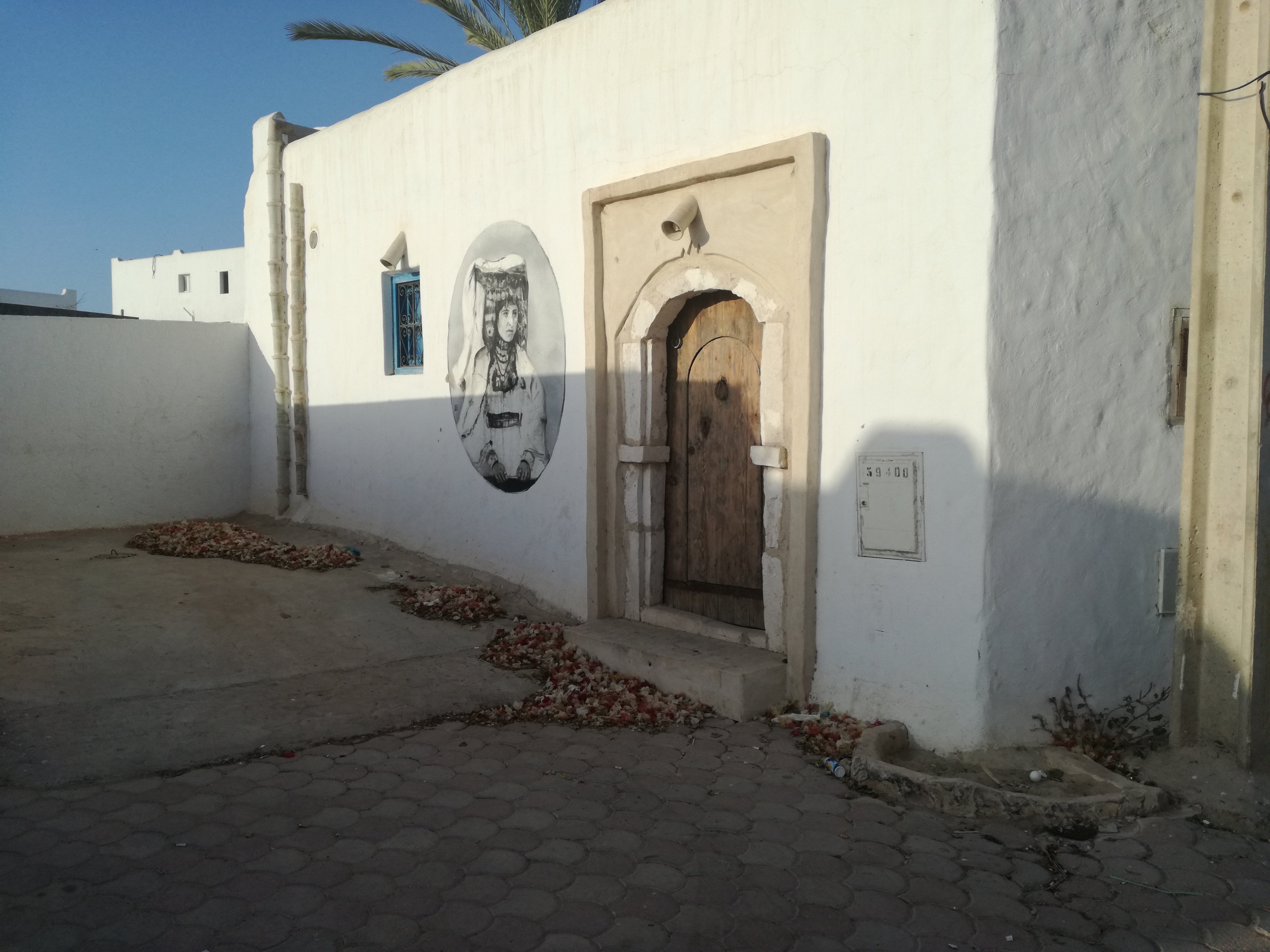
Erriadh (Hara Sghira) and Djerbahood
Erriadh, formerly known as Hara Sghira (“the small Jewish quarter” in Arabic), is one of the two villages historically inhabited by Djerba’s Jewish community. Since 2014 it has also been the home of Djerbahood: more than a hundred murals painted by street artists from around the world have turned the village into an open-air museum. Half a day is enough to walk the streets; bring a camera and good shoes, since some of the frescoes hide in unmarked alleyways. Erriadh is around 15 minutes by car from Tezdaine.
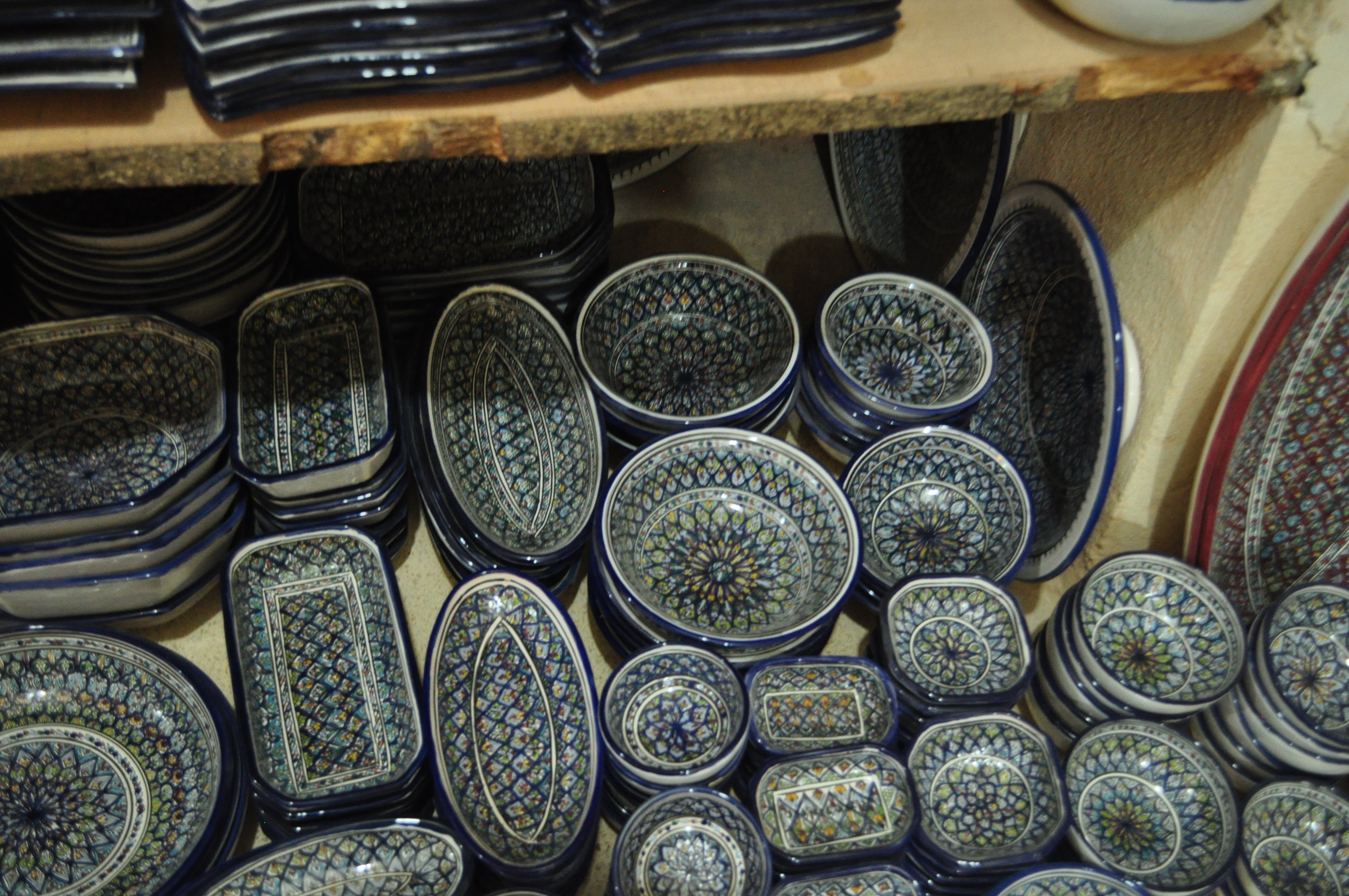
Guellala — the potters’ village
Guellala, in the south of the island, is the historic potters’ village of Djerba. The ceramic tradition here goes back more than two thousand years: oil jars, amphorae and hand-painted tableware are still made today in cave workshops cut into the soft stone. The heritage museum, on the hill above the village, is well worth a visit with children: scale models, scenes of traditional Djerbian weddings, displays on olive cultivation and sponge fishing. From Tezdaine, allow around 30 minutes by car. For official figures, see Tunisian olive groves on UNESCO’s tentative list.
The Ghriba synagogue at Hara Sghira — shared heritage
A few steps from Erriadh, the Ghriba synagogue is one of the oldest synagogues in the world still in use, and the focus of an annual Jewish pilgrimage in the month of Iyar. Djerba is a land where two religious traditions have coexisted for centuries, in a quiet mutual respect that is part of the island’s soul. It is also why the small Sidi Brahim mosque, the dozens of historic multi-domed mosques scattered through the countryside, and the Ghriba together form a religious heritage that has few equivalents in the Mediterranean.
Central Midoun — the Friday market
Central Midoun comes alive every Friday morning with one of the largest markets on the island: spices, olives, fabrics, pottery, fresh fruit and vegetables, hand-made soaps, jewellery. It’s the traditional weekly meeting point for Djerbians and the best place to take home an authentic souvenir. Allow five to seven minutes by car from Tezdaine, or about twenty minutes by bicycle if you’d rather make a morning of it.
Mahboubine and the inland villages
Off the main visitor circuits, Mahboubine and the surrounding villages (Beni Maaguel, Sedouikech, Cedouikech) show a more rural face of Djerba: century-old olive groves, isolated whitewashed mosques in the middle of fields, stone-built menzels. This is where you sense the older Djerba, the one that has barely changed in fifty years.
How to read the map according to your kind of stay
You’re after quiet and authenticity
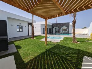
Stay on the east coast outside the Tourist Zone: Tezdaine, the eastern side of Midoun, villages such as Mahboubine or Beni Maaguel. You’ll be a short drive from the wild beaches (Sidi Yati, Sidi Garous), 15-20 minutes from the cultural sites (Erriadh, Houmt Souk), and right inside the everyday Djerbian life. That is exactly the position we hold at Ethic Village Djerba: four single-storey villas in Tezdaine, each with a private pool with no overlooking neighbours, in a family-friendly Muslim-friendly setting.
You want to do everything on foot or by bike
Central Houmt Souk is the most walkable option: medina, port, markets, restaurants all within reach on foot. The trade-off: it is busier, more built-up, with fewer beaches directly at hand. In Tezdaine, by contrast, you have a full daily loop within a 15-minute cycle: the Troujette mosque three minutes on foot for those who pray there, the Khalid Ibn Al Walid mosque five minutes away, the local bakery, the grocer, and the sea a few pedal turns away. Children can move around independently on the back lanes — traffic across the island is generally very light.
You want a pure beach holiday
The Sidi Mahres Tourist Zone is built for that: long beach, hotels with sun loungers, peak-season activities. Be aware though that hotels in Djerba generally serve alcohol and that their pools are shared, which doesn’t suit every family search. For an alternative with a private pool with no overlooking neighbours, a family atmosphere and home-cooked meals, see our guide to long stays at Ethic Village Djerba.
You’re planning a day trip to the mainland
Stay on the western or south-western side of the island (Ajim, Mellita) so the Roman causeway or the ferry are quicker to reach. Allow around 1h45 to 2h to reach Tataouine and its ksour, around 2h30 for Matmata and its troglodyte houses, around 3h30 for Douz and the gateway to the Sahara. Full transport options are gathered in our guide to staying at Ethic Village Djerba.
Useful distances from Tezdaine
You can drive across Djerba end to end in under an hour, but here are some useful reference points from Tezdaine to translate the map into real journey times:
- DJE airport (Mellita) → Tezdaine: ~30 minutes by car
- Tezdaine → Sidi Yati beach: 6 minutes by car
- Tezdaine → central Midoun: 5 to 7 minutes
- Tezdaine → Sidi Mahres (Tourist Zone): ~15 minutes
- Tezdaine → Houmt Souk: ~20 minutes
- Tezdaine → Erriadh / Djerbahood: ~15 minutes
- Tezdaine → Aghir: ~20 minutes
- Tezdaine → Guellala: ~30 minutes
- Tezdaine → Ajim (ferry port): ~40 minutes
- Tezdaine → Troujette mosque: 3 minutes on foot
- Tezdaine → Khalid Ibn Al Walid mosque: 5 minutes on foot
Getting around the map: car, bike, taxi, horse-drawn carriage
Once you’ve got the geography in mind, you still need to move around. Djerba offers several options, each suited to a different style of stay:
Hire car
The most flexible option. All major international agencies (and several reliable local ones) have desks at the airport. Expect on average €30 to €50 per day depending on the season. Driving on Djerba is calm outside the town centres, the main roads are in good shape, but a few minor tracks (notably towards Sidi Yati or Sidi Jmour) are unsurfaced. Essential if you stay outside the Tourist Zone and want to explore Erriadh, Guellala and Houmt Souk freely.
Bicycle
The island is flat, distances between neighbouring villages are short. Bikes are ideal for everyday life around Tezdaine: picking up bread, the Friday market in Midoun, getting to the Troujette mosque (three minutes on foot, or a few pedal turns from further out), heading down to Sidi Yati. Several rental shops offer bikes by the day for €8 to €15.
Taxi and shared taxi
Djerbian taxis (yellow) are plentiful and inexpensive: €5 to €12 for a typical cross-island ride. Shared taxis (“louages”) run mostly between Houmt Souk, Midoun and Ajim. Handy for an occasional outing when you’d rather not drive yourself.
Horse-drawn carriage
More folkloric than practical, a carriage ride is a popular experience for families with young children. You’ll find them in Houmt Souk, in Midoun and near the large Sidi Mahres hotels. Lovely for a quiet afternoon, not for crossing the island.
Climate and seasons — read this with the map
The map alone isn’t enough; you also need the calendar. Djerba enjoys a mild climate year-round, but the north-eastern coast (Sidi Mahres) is windier than the southern coast (Aghir, Guellala), which is more sheltered. Here are the main windows to keep in mind:
- March to May: gentle spring, empty beaches, perfect light for photography. One of the best windows for Djerbahood, Houmt Souk and inland day trips, before the heat of high summer.
- June to September: peak beach season, warm sea, long days. Sidi Mahres gets busier, but Sidi Yati stays calm.
- October and November: a second spring. The sea is still warm into mid-October, and the villages quieten down.
- December to February: a Mediterranean mildness, ideal for long stays and retired travellers. This is also flamingo season in the southern lagoons.
Frequently asked questions about Djerba’s geography
How big is the island of Djerba?
Djerba covers around 514 km². It is the largest island in North Africa. Its shape resembles a rounded square, roughly 27 km east to west and 28 km north to south.
How many municipalities are on the island?
Three: Houmt Souk in the north (the historic capital), Midoun in the east (which includes Tezdaine), and Ajim in the south-west (the ferry port to the mainland).
Where to stay on the Djerba island map for a quiet family holiday?
The Tezdaine area, in the Midoun municipality, is our recommendation: six minutes by car from the wild Sidi Yati beach, 15-20 minutes from the main cultural sites (Erriadh, Houmt Souk), with two mosques within walking distance. Outside the Tourist Zone and its constraints, but well connected to everywhere worth visiting.
How long does it take to drive across the island?
Less than an hour end to end. Houmt Souk to Ajim, for example, is around 25 km, or 35 to 45 minutes depending on traffic.
How is Djerba connected to the mainland on the map?
Two land routes: the restored Roman causeway from El Kantara towards Zarzis (south-east), and the Ajim-to-Jorf ferry (south-west). Most international travellers fly in to Djerba-Zarzis (DJE) airport at Mellita, on the west of the island.
When to look at the map before you book
Ideally before you set your dates, and certainly before you choose where to stay. Many travellers book a hotel from a single photo, only to discover that the “private beach” in the brochure is shared with a thousand other guests, or that the property sits 35 minutes by car from the nearest authentic village. The map saves you from those surprises.
For a stay that combines quiet, secluded beaches, traditional villages and modern comfort, the Tezdaine–Midoun axis is our recommendation for families. To see exactly where our villas sit on the map and what is at your doorstep, browse our villas page with their precise coordinates, or write to us for a personalised recommendation on the area that would suit you best.
In short: your express Djerba island map
- North: Houmt Souk, medina, port, Ottoman fort
- East: Midoun, Tezdaine (where we are based), wild beaches (Sidi Yati), olive groves
- North-east: Sidi Mahres, the Tourist Zone, long sandy beach
- South-east: the tip and Borj Kastil, lagoons, flamingos
- South: Aghir, water sports
- South-west: Guellala, pottery, heritage museum
- West: Ajim, ferry port to the mainland
- Central-east: Erriadh / Djerbahood, street art and shared heritage
- Airport: Mellita (west side), 30 minutes from Tezdaine
With this layout in mind, you arrive on Djerba knowing exactly where you are landing — and the rest of the trip becomes a pleasure rather than a first-day puzzle. We look forward to welcoming you to Ethic Village Djerba, in Tezdaine, in the corner of Djerba we love most.